Unmanned Aerial System (UAS) or “Drone” technology has added a new dimension to the products and services we can now offer our clients. The UAS can fly at very low altitudes and produce high resolution images as sharp as 1.5 cm per pixel. At these altitudes cloud cover becomes less of an issue, meaning fewer weather delays and less unusable imagery.
Photo Geodetic has partnered with UAS professionals to make these new products and services available to our clients.
These services include:
* Low attitude aerial video and image acquisition for site analysis and marketing.
* GIS/ Mapping - 3D orthomosaic/point cloud data down to 3cm, perfect for volume calculations on earthwork projects.
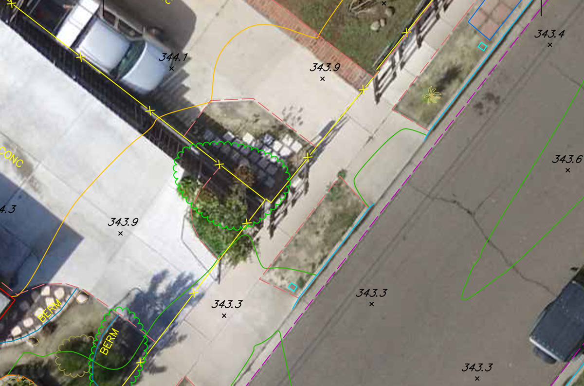
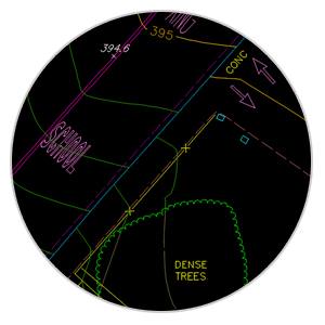
* True topographic and planimetric mapping - Our highly trained professionals utilizing compile conventional mapping products and utilizing UAS low altitude, high resolution photography are able to produce mapping at a level of detail and accuracy never before imagined. The UAS technology in the hands of mapping professionals allows for levels of detail and accuracy never before imagined
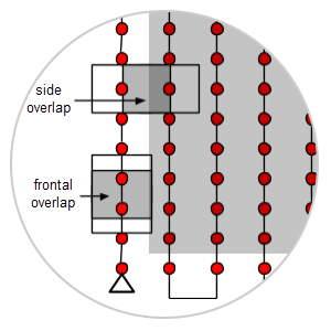
Our experienced staff will work with you to produce a custom flight plan that meets your needs. Once the project is flown we will produce your project, in house, locally and with the quality you know you can depend on.
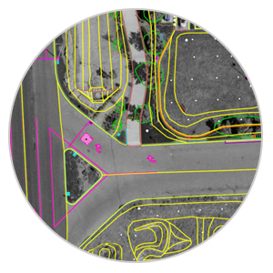
The images are used to collect plan and terrain features. Traditional compiling standards are used to create an accurate, detailed product keyed to the specialized needs of our clients.
An accurate, detailed, and highly polished deliverable. A product that utilizes cutting edge technology and maintains the aesthetic quality of the hand drawn pen and ink products we created in the past.