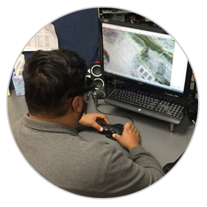
Currently, we utilize DAT/EM Summit Evolution SoftCopy stations. These high tech instruments allow us to collect data directly into the software. Using primarily AutoCad or MicroStation, the base data is produced with multiple layers, colors, and linetypes, and is customized to the end users specifications.
Even with all these changes, Photo Geodetic has not forgotten its proud heritage.We strive to produce a product that utilizes cutting edge technology and maintains the aesthetic quality of the hand drawn pen and ink products we created in the past.
The compiler first collects all hardscape features visible from the photography and delineates any areas that are obscured in the photography. A complete digital terrain model (DTM) file is then created using masspoints and breaklines to define the surface. This dtm file is then used to generate contours while the project is in the instrument and these contours are checked for accuracy by the compiler. Once the compiler is satisfied with the results, the project is turned over to the CAD editing department where the files are combined and a new set of contours are generated. These contours are compared to those generated by the compiler. The CAD operator then adds text to better define areas of the project, dashes and defines obscured contour areas and creates a file that is more aesthetically pleasing and easier to read. This file is reviewed by the CAD manager and compiler before being returned to the technician for any corrections. The technician then translates the file to the client’s specifications. Finally, the files and hardcopy drawings are reviewed against the original photography for completeness and quality.
.
.

Our team uses Summit Evolution world class photogrammetry stations to produce our high quality maps.
Summit Evolution Professional stations provides us a set of powerful tools for extracting 3D information from stereo data. The software includes CAD and GIS interfaces, 3D stereo vector superimposition, automated feature editing, contour generation and many more tools.
Our highly trained CAD technicians come from a background of pen and ink drafting and are true artists of their craft. Combining their skills and years of experience has made it possible for Photo Geodetic to produce mapping products that are not only highly accurate, but are also well rooted in the artistic traditions of cartography.
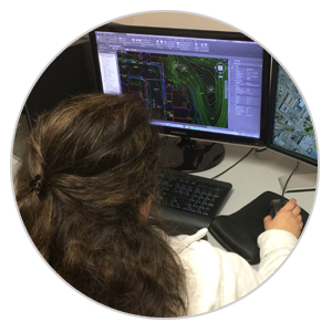
Quality control is key when mapping existing conditions for any project. We are keenly aware that a project’s future design and engineering decisions will be based on the data we provide. Photo Geodetic has therefore devised a rigorous quality control system to insure the accuracy and completeness of our products. Our editing team is also trained to properly translate and format our files to meet the needs of multiple end users.