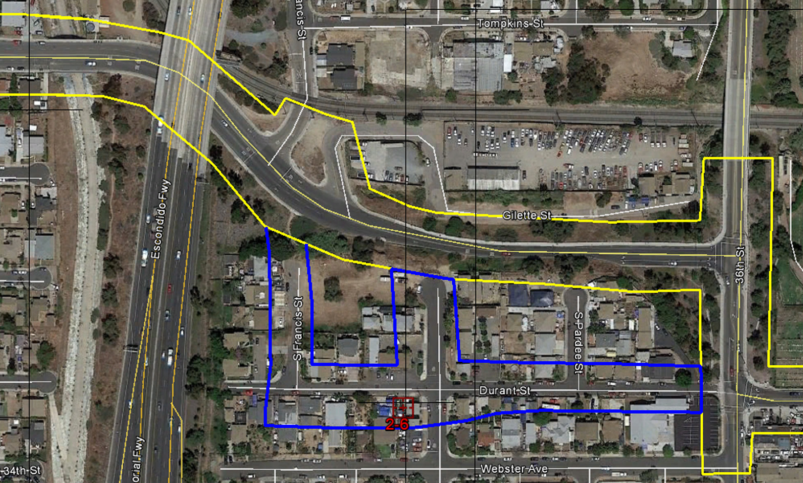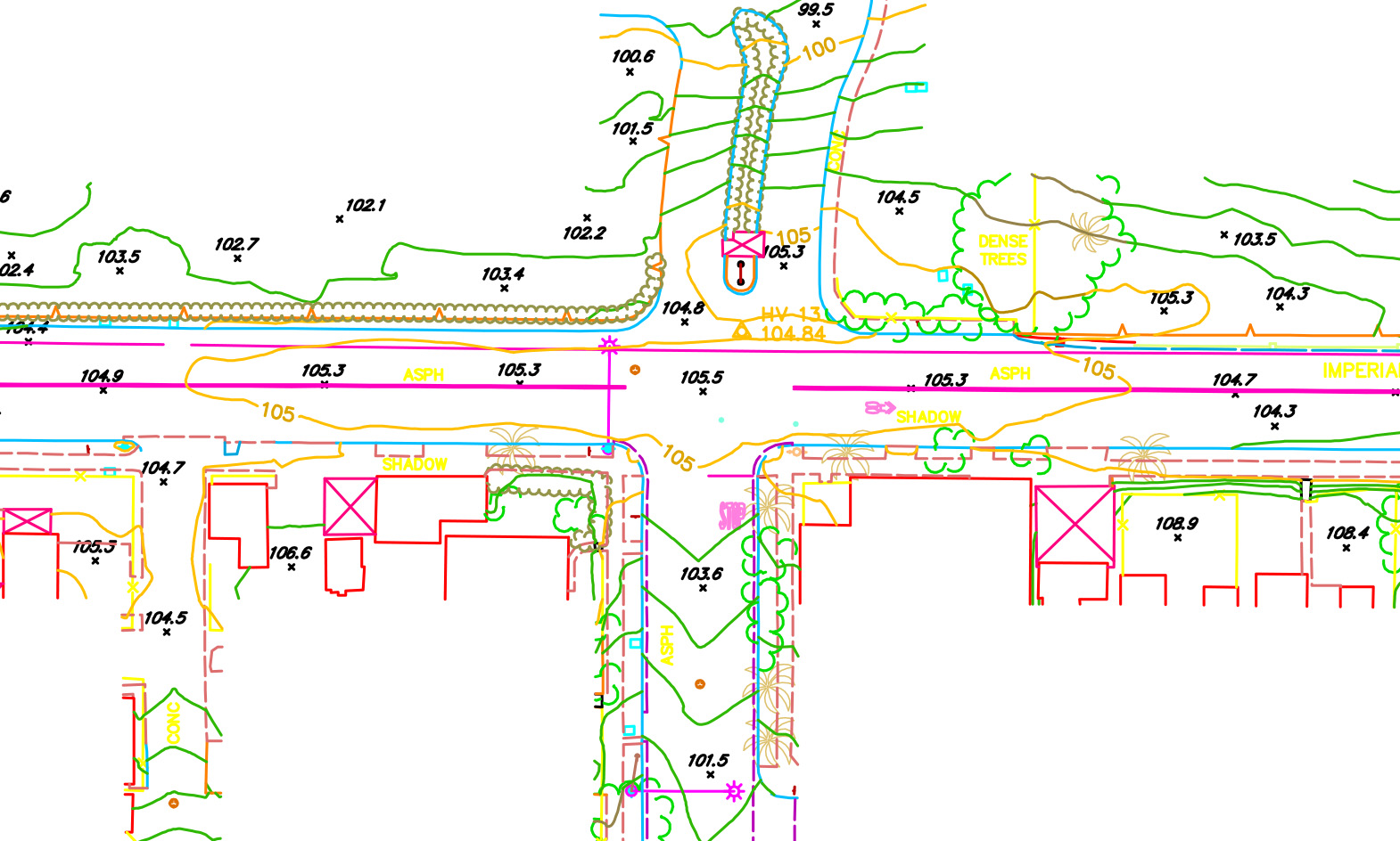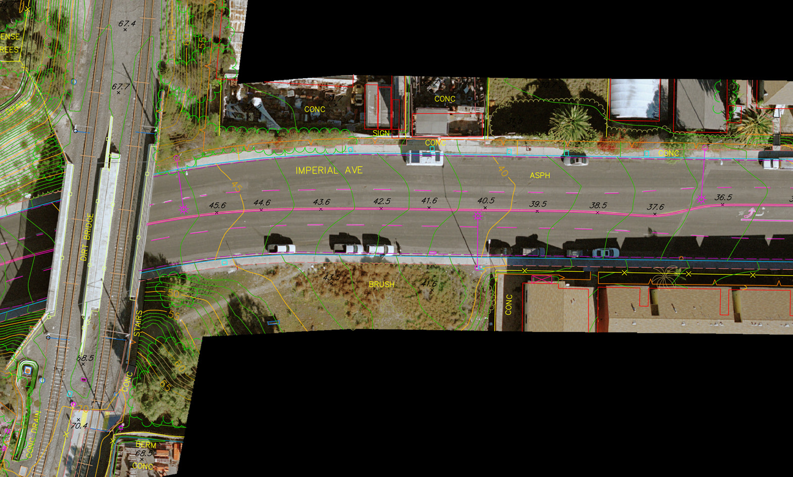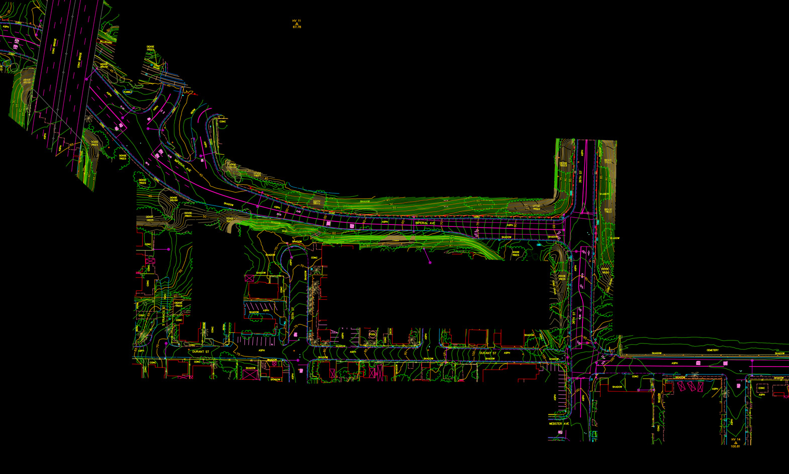
In any community the upkeep and maintenance of its utility infrastructure is crucial. Over the past 20 years Photo Geodetic has been chosen to supply the City of San Diego with the base mapping for a number of Utility Group projects. These complex projects are identified and flown in color. The city survey crews then provide a comprehensive ground survey of the site which includes the coordinates and surveyed elevations of all utilities. This data is incorporated into the collection of the mapping and the digital terrain model (DTM) data files in order to insure accurate surface elevations of the utilities.
After collection and general edit, Photo Geodetic’s personnel field check all data and identify utilities by type and description. This data is used to prepare the utility layers. Final files are translated to City of San Diego specifications in Microstation.DGN format and color orthophoto overlays are produced of the sites for final delivery.
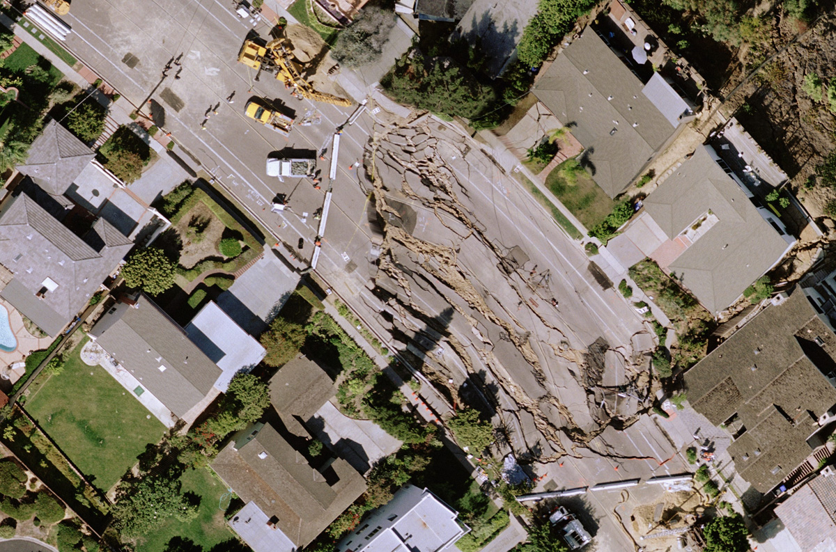
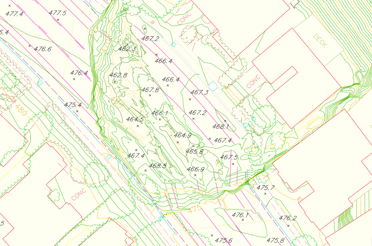
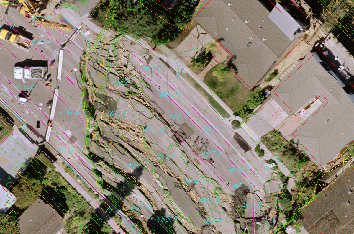
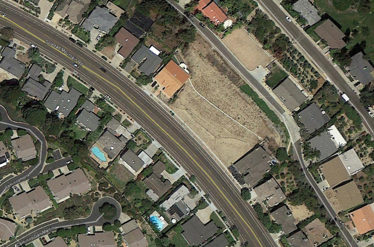
Photo Geodetic has provided base mapping for a number of Pivate Sector jobs.

In any community the upkeep and maintenance of its utility infrastructure is crucial. Over the past 20 years Photo Geodetic has been chosen to supply the City of San Diego with the base mapping for a number of Utility Group projects.

Southern California has a long tradition working with all the branches of the U.S. Military. Photo Geodetic is proud to have been involved in numerous major projects for the various branches of our armed services.